Route-Based Weather Forecasting: What It Is, Why It Matters, and How to Use It
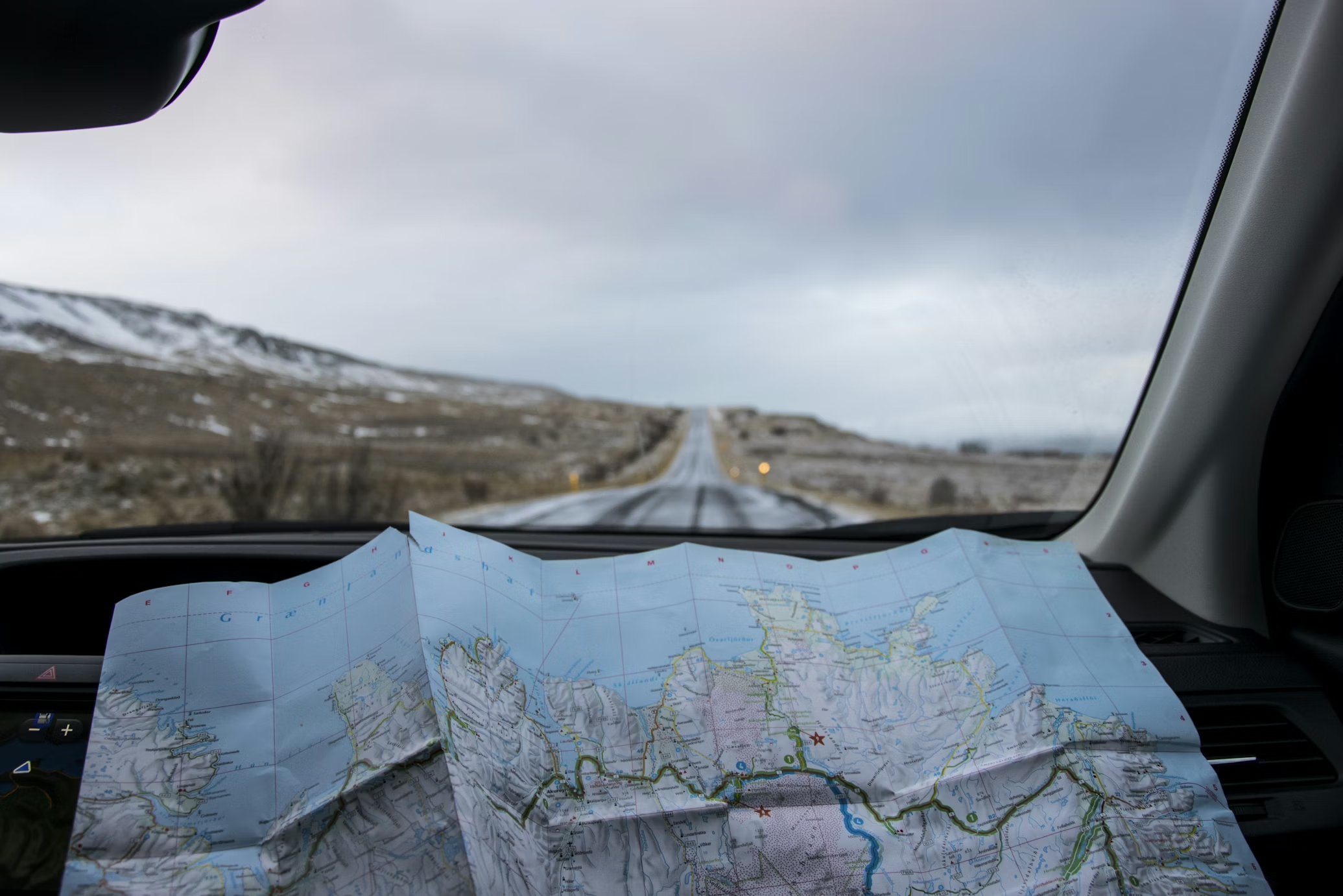
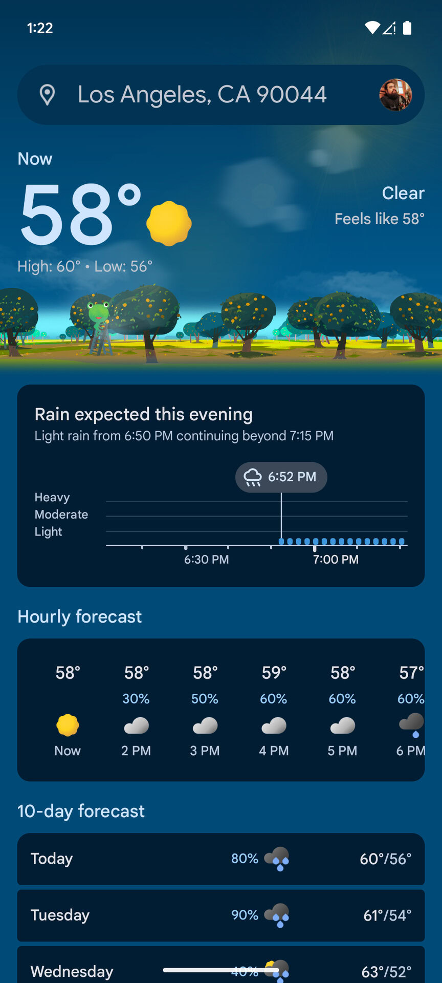
Most weather apps show the forecast for a single city or location. That works for short trips, but it breaks down for multi-day tours where weather changes every hour and every kilometer. Route-based weather forecasting solves this by showing how conditions like rain, wind, temperature, and storms evolve along your route and over time, instead of at one fixed point. This guide explains what route-based weather forecasting is, why city forecasts are not enough for long journeys, and how cyclists, drivers, and motorcyclists use route-aware forecasts to plan safer trips.
What Does “Weather Along a Route” Mean?
Traditional weather forecasts show conditions for a fixed point, like a city or GPS location.
Weather along a route means forecasting conditions at multiple points along a planned journey, timed to when you will actually arrive there.
For example, instead of seeing today’s weather in Wyoming and Montana, you see:
- Rain at kilometer 80 when you arrive at 14:00
- Headwinds on a mountain pass at 17:00
- A thunderstorm in the valley at 19:00
This is called route based weather forecasting.
Why City Based Weather Forecasts Are Not Enough for Long Trips
City forecasts assume you stay in one place whereas, in reality, long trips move through many weather zones.
City based forecasts cannot:
- Predict weather changes along a cycling route
- Show wind direction and speed on exposed roads
- Highlight storms you will encounter later in the day
- Account for timing along a route
For cyclists, motorcyclists, and road trippers, this can lead to riding into storms, strong headwinds, or dangerous conditions without warning.
Best Apps That Show Weather Along Your Route
Weather on the Way
Best for route based weather forecasting
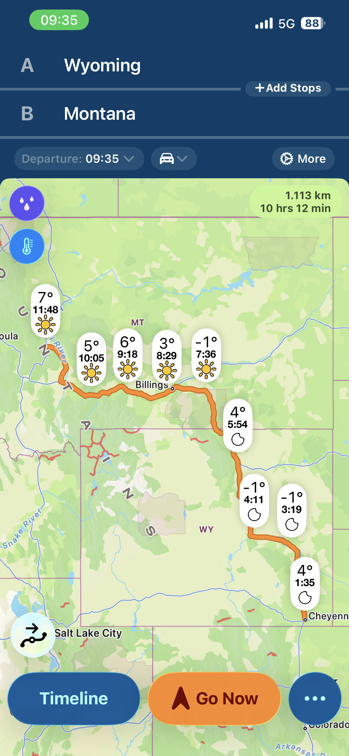
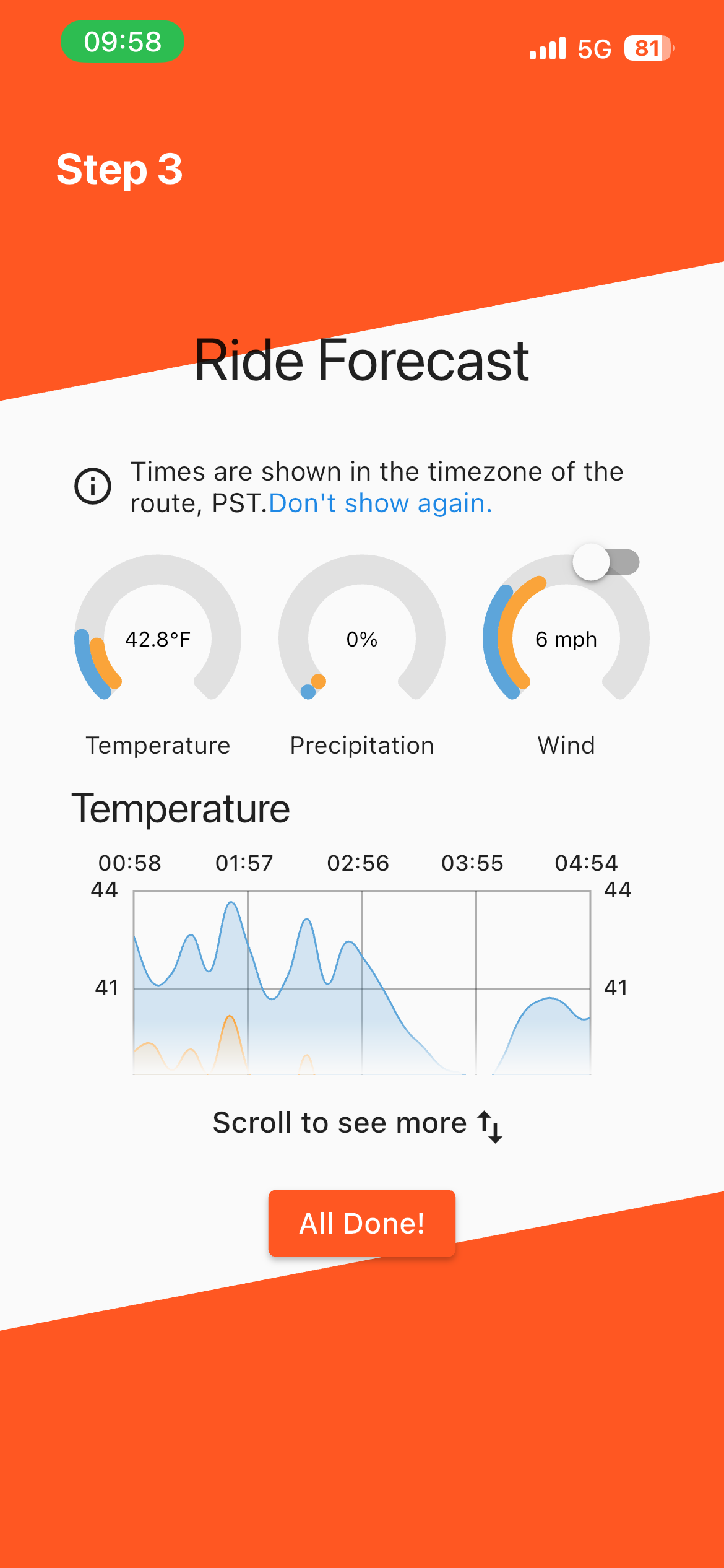
Weather on the Way lets you plot a route and see weather conditions along the entire journey. It shows:
Instead of static city forecasts, the product calculates your ETA automatically, aligns precise weather data to every segment of your journey, and updates continuously as conditions, speed, or routing change. You see forecasts tied to your future location, not where you happen to be right now.
That makes it a powerful tool for avoiding storms, choosing the right time to leave, planning winter drives, and staying ahead of fast-changing conditions. With CarPlay support, live updates, alternative routes, custom waypoints, and route-following radar, it is designed to reduce uncertainty without adding effort.
Why it stands out:
• Automatically matches weather to your ETA across the entire route
• Helps you decide when to leave based on changing conditions
• Updates in real time as your speed or route changes
• CarPlay support for safe, glanceable use while driving
• Live rain and snow radar that follows your actual route
• Instantly builds routes with car travel as the default
• Shows the most relevant weather layers without manual setup
• Includes visibility, wind, gusts, feels-like temperature, road closures, and chain controls
• Supports custom stops, alternative routes, unlimited trip length, and GPX imports
• More predictive and automated than manual, dashboard-style weather apps
• Proven satisfaction among US drivers, motorcyclists, and long-distance travelers
Who it’s for:
Drivers who want an intelligent, automated forecast that works in the background, updates itself, and removes the need to manually piece together weather from multiple locations.
Epic Ride Weather
Why it stands out:
• Matches weather to your exact ETA at every point along the ride
• Shows wind, rain, temperature, and real-feel conditions
• Makes it easy to choose the best direction by visualizing headwinds and tailwinds
• Accounts for exposure and effort, not just raw temperature
• Supports smarter clothing choices with wind chill and real-feel data
• Highlights heat and cold stress to help plan nutrition and hydration
Who it’s for:
Epic Ride Weather is built specifically for cyclists, not adapted from generic weather tools.
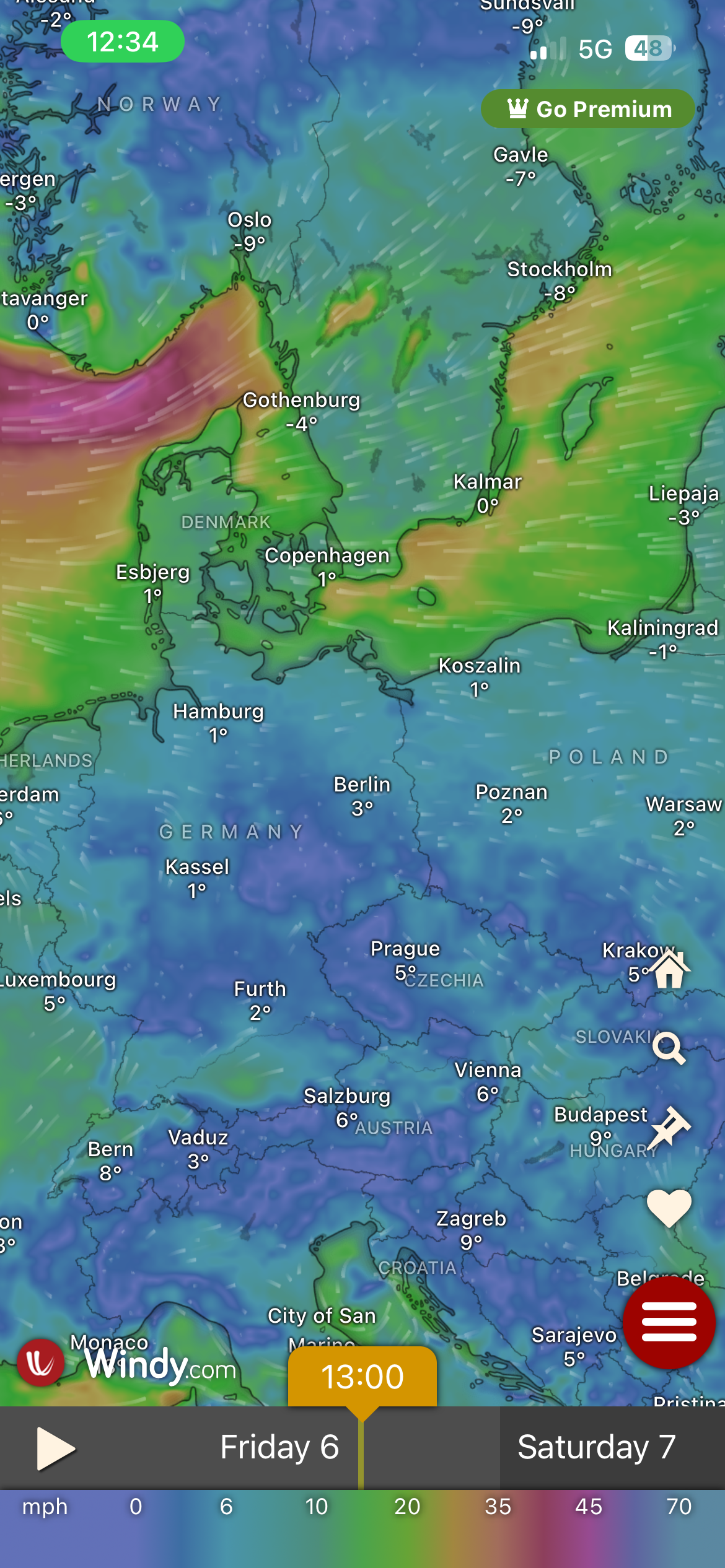
Windy
Great weather visualization but not route timed
Windy is excellent for visualizing wind, rain, and pressure systems on maps. However, it does not simulate weather conditions along a route over time. It is best used alongside a route based tool.
Why it stands out:
Built for wind, water, and outdoor sports, not casual city forecasting
• Live global wind maps with rich visual detail
• Access to multiple professional weather models for comparison
• Detailed 10 day forecasts with high spatial resolution
• Designed for checking conditions at specific spots, not just locations
• Community insights through spot reports and user contributions
• Easy comparison of conditions across different spots and regions
• Educational meteorology content for users who want to go deeper
Who it’s for:
Widely used by pilots, sailors, kitesurfers, paragliders, and outdoor professionals.
Which weather apps don't display route-based forecasts?
Apple Weather and Google Weather
Good for short local rides
Default weather apps are convenient for quick checks but are not designed for long distance route planning.
Why they stand out
• Preinstalled and instantly accessible on most smartphones
• Optimized for quick, everyday weather checks
• Clean, simple UI designed for broad consumer use
• Reliable current conditions and short term forecasts
• Strong integration with system features like notifications, widgets, and voice assistants
• Location based forecasts that update automatically in the background
• Easy to check temperature, rain probability, and hourly trends at a glance
• Suitable for casual planning like commuting or deciding what to wear
• Low friction experience with no setup required
• Trusted default option for millions of users worldwide
How Cyclists and Road Trippers Use Route- Based Weather Forecasts
Planning long cycling tours
Cyclists use route forecasts to:
- Avoid storms on mountain passes
- Plan rest stops around rain windows
- Choose routes with tailwinds instead of headwinds
Road trip planning
Drivers use route weather forecasts to:
- Avoid severe weather zones
- Adjust departure times
- Reroute around storms
Motorcycle touring
Motorcyclists use route weather data to:
- Avoid high winds on exposed highways
- Plan around temperature drops in mountains
- Avoid riding in heavy rain or thunderstorms
How to Check Wind and Rain Along Your Cycling Route
- Plot your route in a route based weather app like Weather on the Way.
- In most cases, you can also use a GPX import if you've already created your route in another app or program.
- Check wind speed and direction along exposed sections
- Look for rain or storm cells along the timeline of your ride
- Adjust departure time or route if dangerous conditions appear
- Recheck forecasts the morning of the ride
When Route Based Weather Forecasting Matters Most
Route based forecasts are most useful for:
- Rides longer than 50 km
- Multi day bikepacking trips
- Mountain or coastal routes
- Road trips through multiple regions
- Motorcycle tours with exposure to wind and storms
For short urban rides, a city based forecast is usually enough.
Summary: Route Based Weather Forecasting for Long Trips
- City based weather apps show forecasts for one location
- Route based weather apps simulate weather along your journey
- Cyclists, drivers, and motorcyclists benefit from route forecasts
- Weather on the Way and Epic Ride Weather are examples of route based tools
For long trips, route based weather forecasting provides a clearer picture of rain, wind, and storms before you start.


